Our Equipment
At Pinnacle Drone Solutions PTY LTD, we believe that delivering top-tier data requires top-tier technology. Our fleet is powered by the industry leading DJI Matrice 400 platform, equipped with state of the art visual, thermal, and LiDAR payloads. This allows us to operate safely in complex environments and deliver unparalleled accuracy for surveying, inspection, and emergency response.
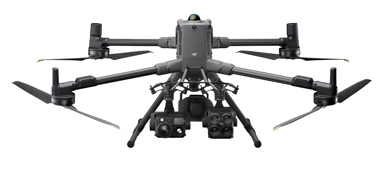
Matrice 400
Power-Line-Level Obstacle Sensing: Integrates rotating LiDAR, high-precision millimeter-wave (mmWave) radar, and full-colour low-light fisheye vision sensors. This allows the M400 to safely detect and avoid incredibly thin obstacles like high-voltage power lines across mountainous terrain—even in complete darkness, heavy rain, or fog.
Class-Leading Endurance: Boasts an outstanding 59-minute maximum forward flight time (53 minutes hovering), maximizing on-site efficiency and enabling long-duration search and rescue or large-scale mapping without frequent battery swaps.
Heavy-Lift & Multi-Payload Capability: Features an upgraded 6kg payload capacity supporting up to 7 simultaneous payload configurations via E-Port V2, allowing us to combine advanced sensors, spotlights, and speakers on a single flight.
AR-Powered Situational Awareness: Utilizes cutting-edge augmented reality overlays on the pilot's remote controller, projecting real-time power line tracking, flight path previews, and terrain hazards to ensure maximum operational safety.
Marine & Offshore Capability: Built with an IP55 weather-resistance rating and advanced fusion positioning, the M400 supports ship-based takeoff and landing on moving vessels for offshore wind and maritime patrols.

H30T
Unprecedented Zoom Power: Equipped with a 40MP Zoom camera supporting an incredible 34× Optical Zoom and up to 400× Digital Zoom, letting our pilots inspect minute details on live assets from ultra-safe standoff distances.
High-Resolution Thermal Imaging: Features a next-generation 1280×1024 infrared sensor with up to 32× digital zoom. It safely measures temperatures up to 1600°C, making it a critical asset for solar farm inspections, utility hot-spot detection, and active fire management.
Precision Laser Rangefinder: Provides immediate geospatial context by instantly measuring the exact coordinates and distance of objects up to 3,000 meters away.
Full-Color Night Vision: Employs advanced intelligent algorithms to capture sharp, full-color imagery in near-total darkness, drastically upgrading our 24/7 emergency response and surveillance capabilities.
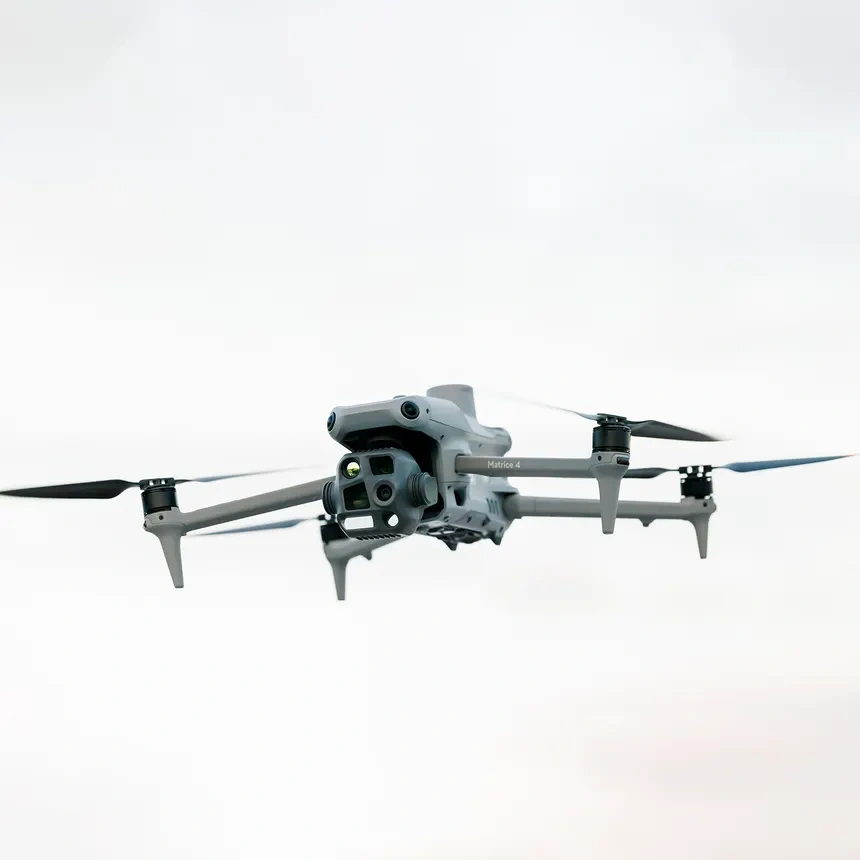
Matrice 4T
Wide-Angle Camera
1/1.3″ CMOS, 48MP Effective Pixels, f/1.7, Format Equivalent: 24 mm
Medium Tele Camera
1/1.3″ CMOS, 48MP Effective Pixels, f/2.8, Format Equivalent: 70 mm
Tele Camera
1/1.5″ CMOS, 48MP Effective Pixels, f/2.8, Format Equivalent: 168 mm
Laser Range Finder
Measurement Range: 1800 m (1 Hz); Oblique Incidence Range (1:5 Oblique Distance): 600 m (1 Hz) Blind Zone: 1 m; Range Accuracy (m): ± (0.2 + 0.0015 × D)
Infrared Thermal Camera
Resolution 640 × 512, f/1.0, Equivalent Focal Length: 53 mm, Uncooled VOx Microbolometer, Supports High-Res Mode
NIR Auxiliary Light
FOV: 6°, Illumination Distance: 100 m